Image taken by local resident Flora Katzer (submitted photo/Flora Katzer)
Funnel Cloud Footage

Environment Canada seeking footage from recent tornado warning event in Meadow Lake, temperatures warm up next week

Jul 24, 2020 | 3:11 PM

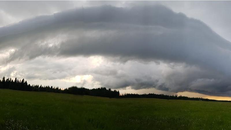
Meadow Lake and area residents may have been startled by a tornado warning alert issued by Environment Canada at approximately 6 p.m. on Thursday. A severe thunderstorm warning issued throughout the day on Thursday later developed into a tornado warning.

Meteorologist Terri Lang told meadowlakeNOW that Environment and Climate Change Canada (ECC) is seeking confirmation of yesterday’s weather event through local footage of funnel clouds or any documentation of damage caused by weather.

“With severe weather, tornadoes are possible,” she said. “That warning was issued based on what forecasters were seeing off the radar. They could see the storm was strongly rotating which usually is the first indicator that a storm may produce a tornado.”

Lang said one individual reported seeing a strong rotation over Meadow Lake but there is no footage of such to verify if the weather event even happened.

“Without a photo, anyone can say anything,” she said. “Were hoping to release a tweet later today asking for any information on whether anyone saw anything or whether damage was reported.”

Last year, Meadow Lake experienced a few tornados which affected Meadow Lake Provincial Park causing significant damage to the area. Lang said ECC places emphasis on public safety during severe weather events. When you hear a tornado warning it can be quite startling and knowing what to do could be life-saving.

“We always emphasize, get into the lowest part of the house. If you have a basement, get into the basement,” Lang said. “If you don’t have a basement, go to an interior room, hopefully without windows. You want to put as many walls between you and the outside.”

If Meadow Lake and area residents have footage or images of last night’s tornado warning event, email to SKstorm@canada.ca or use the Twitter hashtag #SKstorm. Environment Canada cannot access footage through Facebook.

Additional tornado and severe weather safety tips can be found here.

Temperatures expected to warm-up next week

In the midst of summer, Lang said while temperatures have cooled off today (July 24) and will be on the cool side over the weekend, heat is expected return next week. The public is advised to be prepared and to stay hydrated.

If you need to be outside, go out during the cooler parts of the day, either morning or evening. The warmest part of the day occurs around from 3 p.m to 5 p.m. Incoming radiation from the sun warms up the earth and earth re-emits heat which presents a lag time in warm temperatures during the day.

“We’ve found that people are okay with one day of a heat event but when it stretches over two days, your body doesn’t have a lot of time to recover if it’s warm during the night,” she said. “After two days people really start to feel the effects of the heat.

ECC criteria for heat warnings vary from North to South. Meteorologists look for two consecutive days with temperatures of 29 degrees Celsius or greater, overnight lows of 14 degrees or humidex values of 34 or greater before issuing a heat advisory.

“If you can get things done in the morning or evening, that’s better,” she said. “We used to advise people to go into a covered space with air conditioning, but of course now with the pandemic, so many things have closed which makes it a little more difficult to find cool spots.”

nicole.reis@jpbg.ca

Twitter: @nicolereis7722

View Comments